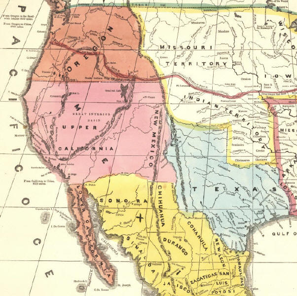
Alta California
Postal History to California Statehood

PDF file of exhibit here
 (the 22 pages below)


While a Spanish colony, the Province of Alta California encompassed the present day states of California, Nevada and Utah as well as parts of four additional states. The Mexican Constitution of 1824 designated this area as Alta California Territory with Monterey as the capital. In 1836 Alta California (as shown on map in pink) was recognized as a department of Mexico and was granted some additional autonomy. The United States occupied much of the area during and following the Mexican-American War and a "state" of California was formally organized at a constitutional convention held in Monterey in late 1849. This provisional state of California, with boundaries as present, never became a territory of the United States. Instead, full statehood was granted by Congress on September 9, 1850, the same day Utah
Territory was organized.


1846 Map showing Alta California in pink

This exhibit is a survey of the postal history of the area during the period from 1810 until statehood in 1850. It is organized in roughly chronological order along the following outline:

1. Spanish Colonial Period - between 1768 and 1822 during which Alta California Province was administered as a colony of Spain

2. Mexican Period - between 1824, when the area was first recognized by the Mexican constitution and August 17, 1846 when Commodore Robert Stockton proclaimed that California was part of the United States.

3. Military Government Period - from August 17, 1846 until December 20, 1849 during which the area was governed by United States Military Governors.

4. Provisional State Period - from December 20, 1849, when a state constitution was implemented and Peter H. Burnett became the first civil governor, and the official statehood date of September 9, 1850.


Highlights of the collection include several historically important letters. These include a Spanish Colonial period use from Mission San Jose in 1810; two letters relating to the aborted conquest of Monterey by the US Navy in 1842; an August 1849 letter from Sutter's Mill; a letter from a member of the Boundary Commission at Camp Riley, near San Diego, dated while setting the southern boundary of the state; and a letter from a delegate to the California Constitutional Convention written while in session in Monterey in 1849 and dated from the Convention Hall.

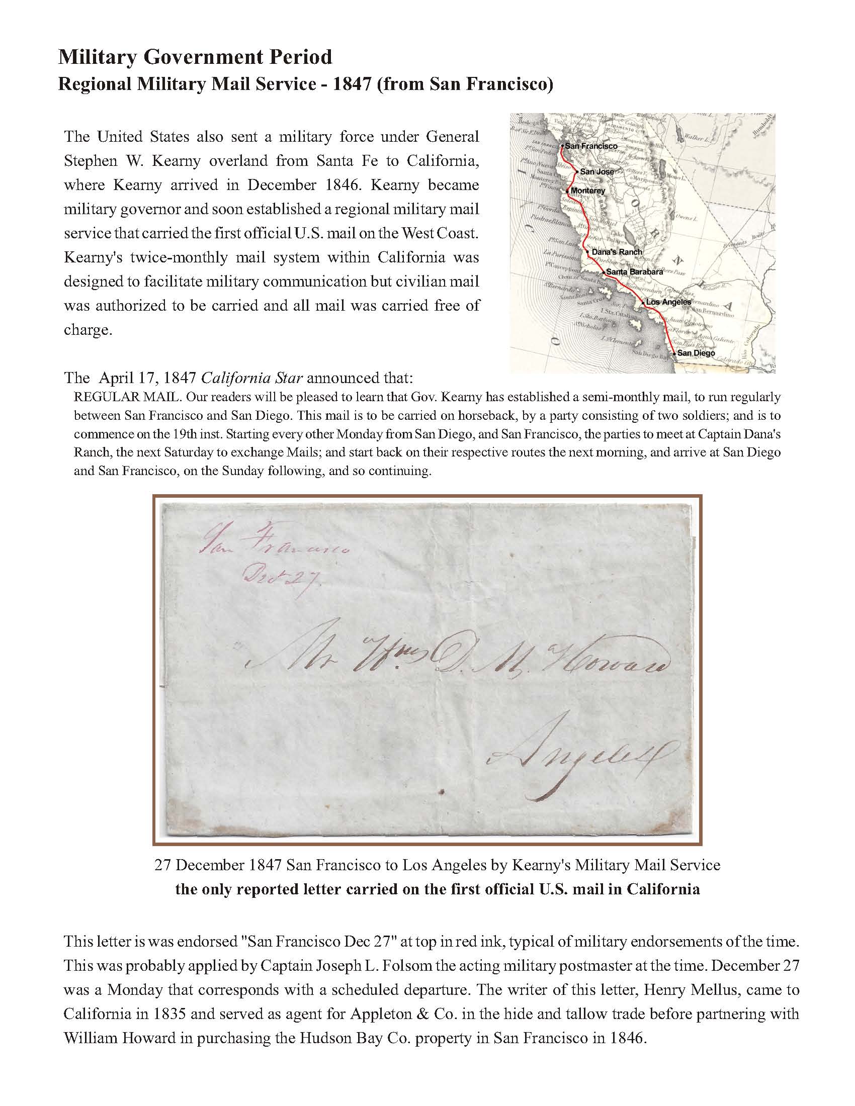
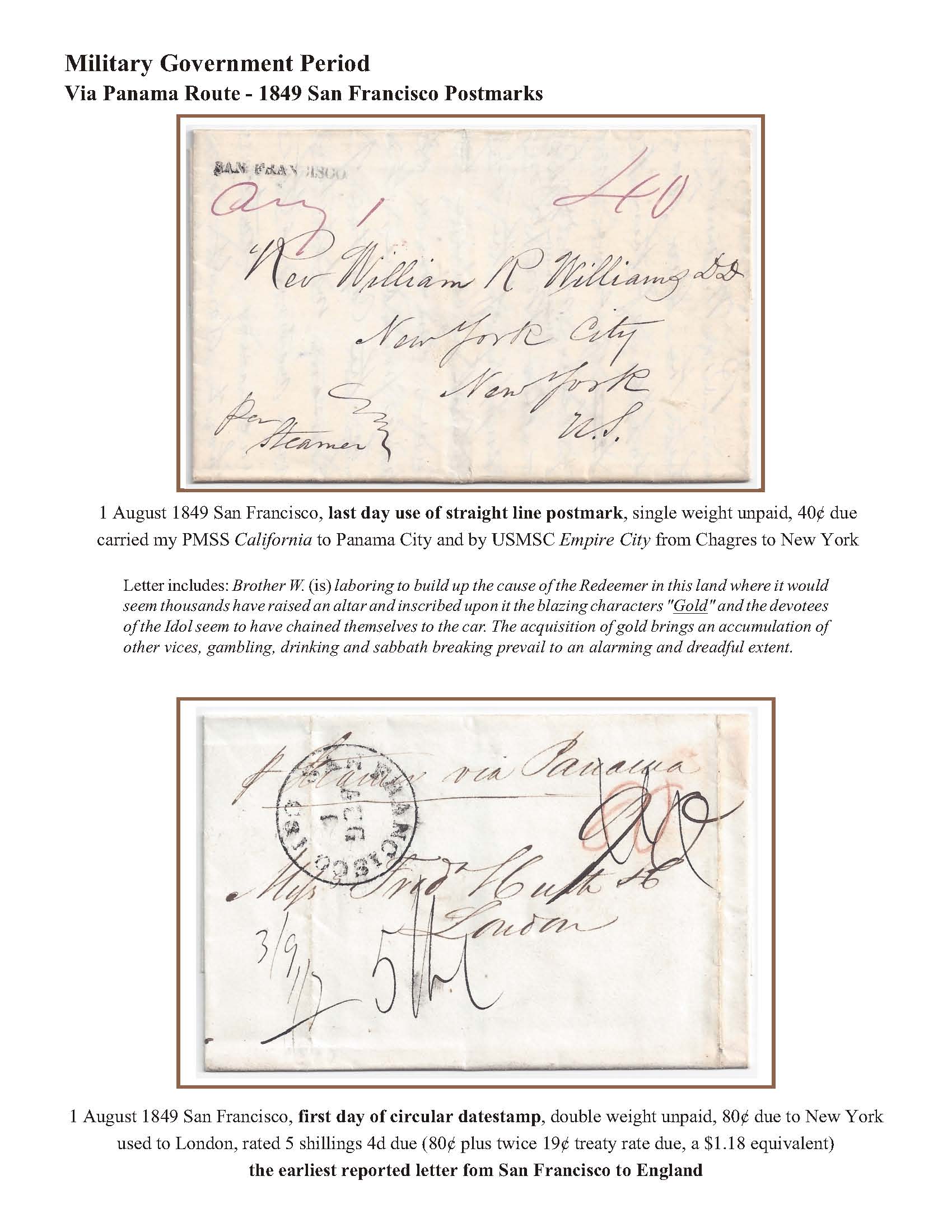
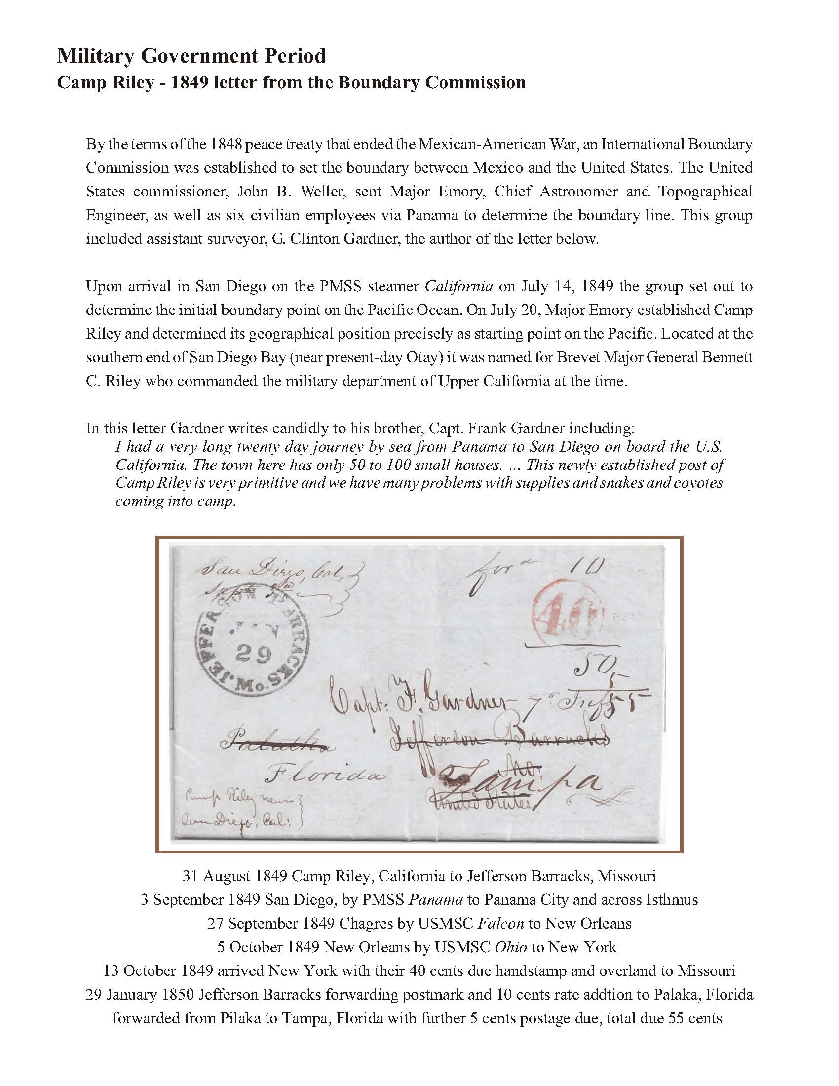
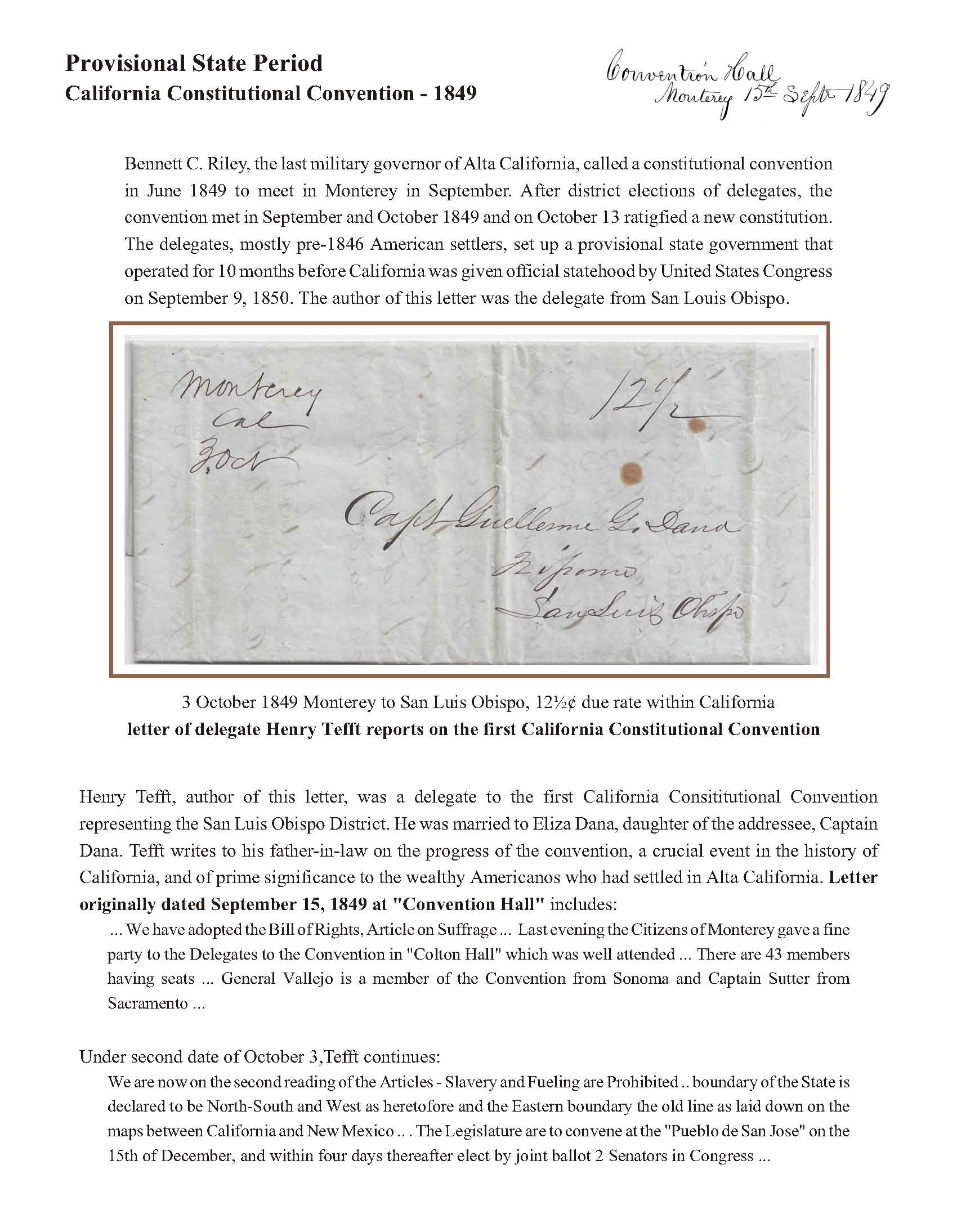
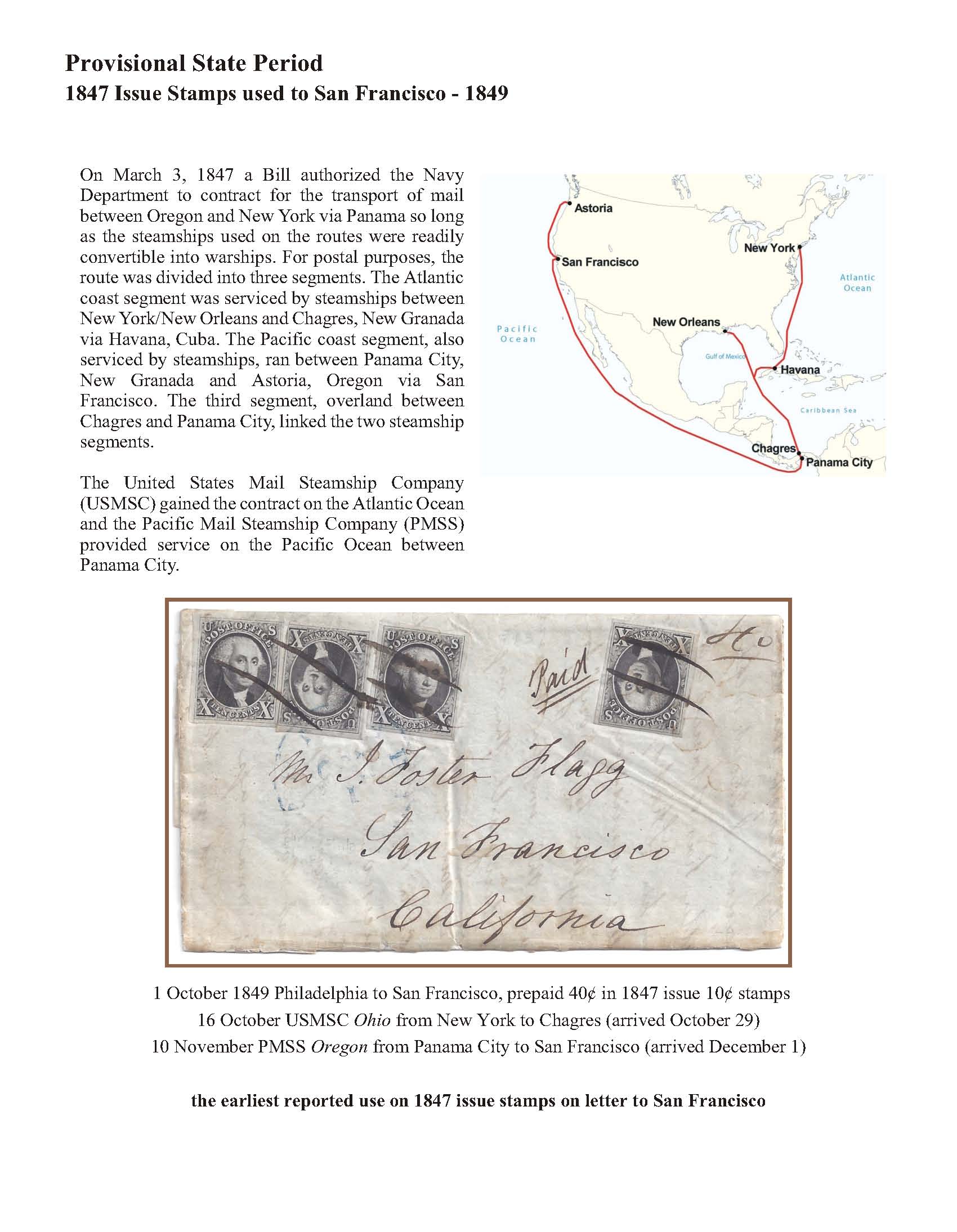
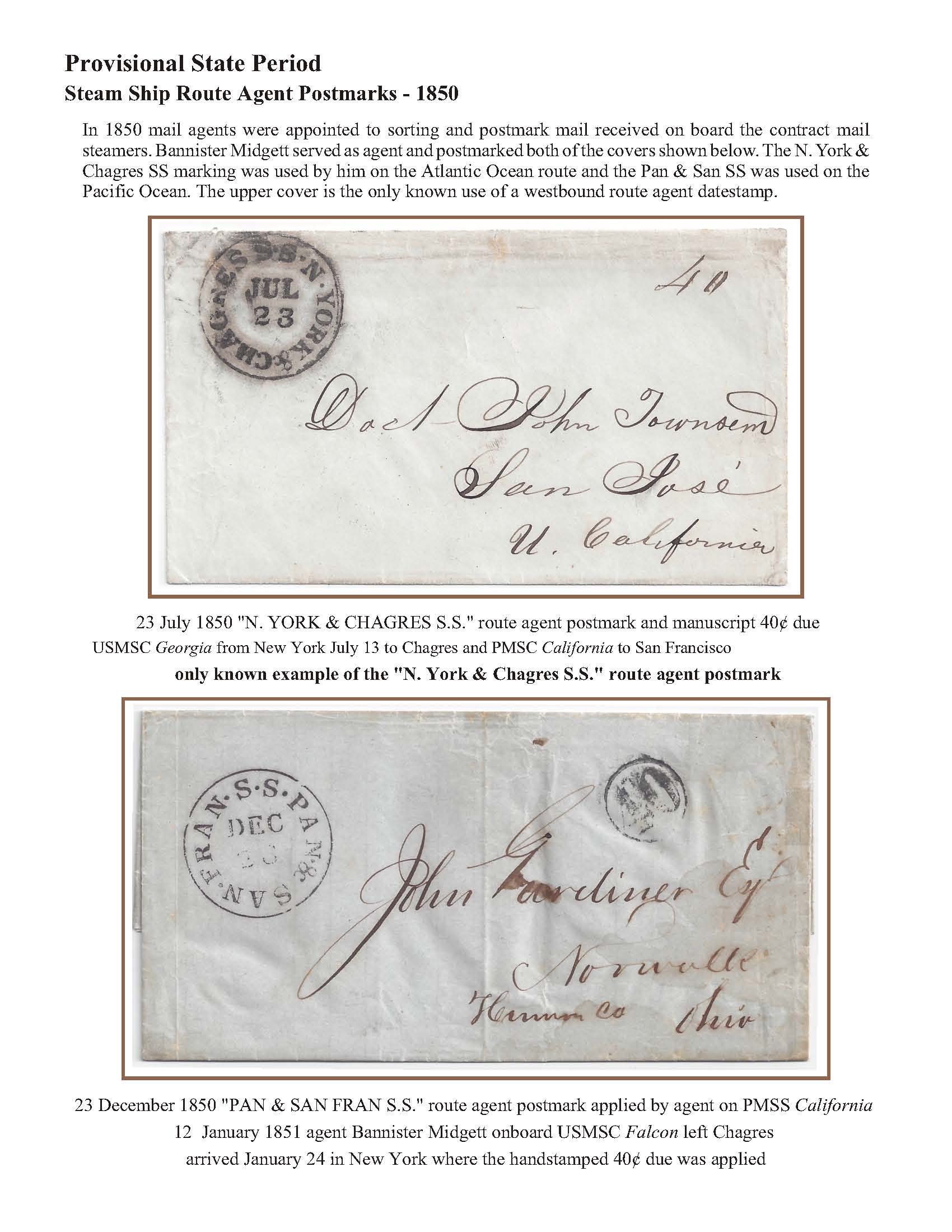
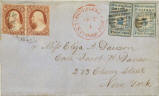
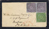
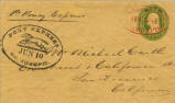
Important postal history artifacts include the only reported Mexican Period use of a postmark from what is now California; an 1847 letter from the USS Congress carried by Kearny's overland mail; the only reported letter carried by the intra-California military mail route; the earliest reported use of US stamps on a letter to California, the unique New York & Chagres route agent handstamp and two uses from Salt Lake City while part of California.

click thumbnail for large view


Richard Frajola (December 2015)